

Warmer night expected ahead of a cold front tomorrow
MACON, Georgia (41NBC/WMGT) – Warmer, more humid air is moving into Georgia ahead of a cold front arriving tomorrow morning.
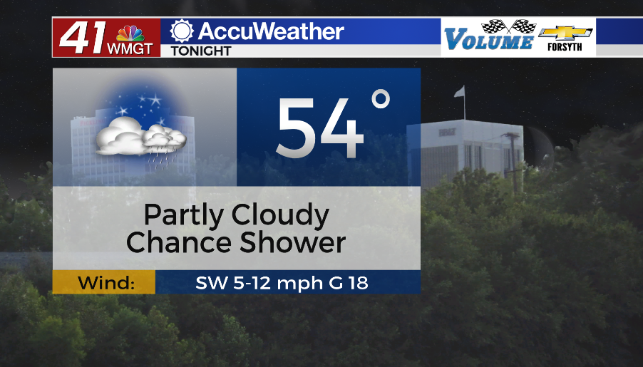
Overnight
Partly cloudy skies are likely overnight tonight ahead of the cold front tomorrow morning. Showers are unlikely, but one or two cannot be ruled out, especially late this evening. Winds will continue to feed in from the southwest at about 5-12 mph. Temperatures will only drop into the low to mid 50s, or up about 5-10 degrees from earlier this morning.
Tomorrow
It will be a bit of a wet start to the final day of the work week as a cold front brings some showers and a few thunderstorms through Middle Georgia. These will likely arrive shortly after sunrise, lasting into the later morning hours for the southeastern counties. Some scattered afternoon showers and storms will be possible as well, mainly for the eastern third of the region. Winds will shift from the southwest to the northwest throughout the day with sustained speeds of 10-20 mph and gusting up to 30 mph. Temperatures will peak in the mid to upper 70s around the region with more sunshine expected over the back half of the day.


Tomorrow night expect clear skies and breezes to continue from the northwest at about 5-10 mph. Temperatures will drop into the upper 40s and lower 50s around Middle Georgia to begin our Saturday.
The Weekend
It will be yet another breezy weekend with plenty of sun expected Saturday however Sunday will see a bit more cloud cover. Temperatures both days should rise into the upper 70s.

Follow Meteorologist Aaron Lowery on Facebook (Aaron Lowery 41NBC) and Twitter (@ALowWX) for weather updates throughout the day. Also, you can watch his forecasts Monday through Friday on 41NBC News at Daybreak (5-7 a.m.) and 41Today (11 a.m).