Fall conditions continue to stick around
MACON, Georgia (41NBC/WMGT) – Temperatures will remain below average heading into the middle of the week.
Overnight


Cloud cover from the afternoon has cleared out, leaving Middle Georgia with clear skies the rest of the night. Temperatures will drop down into the lower 40s, however north-northwest winds of 5-10 mph could lead to wind chills in the upper 30s.
Tomorrow


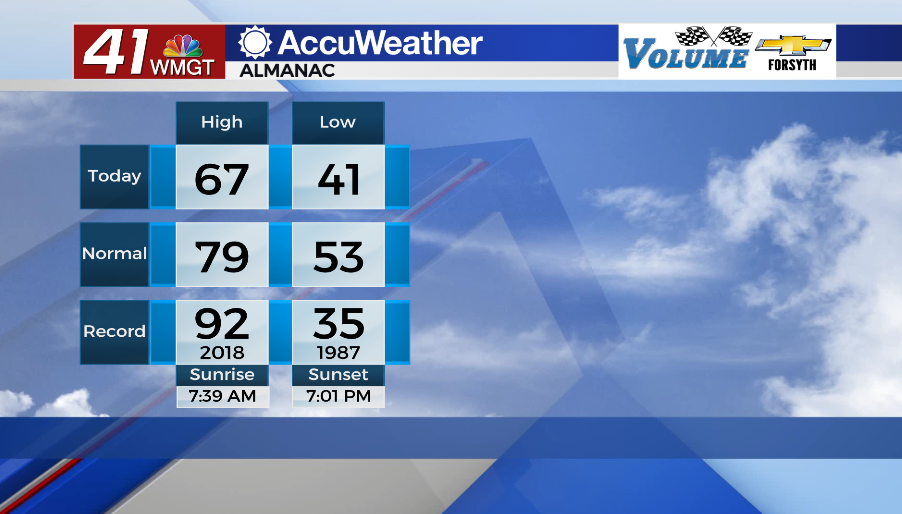
Mostly sunny skies are expected with much calmer winds from the north (around 5 mph or so). Temperatures will climb into the upper 60s around the region during the afternoon. This is about 10 degrees below the average for this time of year.


Overnight skies will remain clear with lows dropping into the low to mid 40s. The winds will be variable and ultimately out of the south at around 5 mph by Wednesday morning.
Wednesday and Beyond


Wednesday will see sunny conditions as high pressure moves to the east just north of the Peach State. This will lead to ambient winds from the southeast around 5-10 mph, slowly adding some moisture to the atmosphere and beginning the return flow process. High temperatures will peak in the lower 70s for most of the region. Overnight lows will drop into the mid to upper 40s as winds shift more southward.
Thursday will see cloud cover ramp up with winds from the south-southwest at about 7-12 mph. An incoming cold front could bring some rain beginning overnight and into Friday with the bulk expected over the first half of the day on Friday. Storms should clear out Friday evening leading to another sunny and breezy weekend around Middle Georgia.

Follow Meteorologist Aaron Lowery on Facebook (Aaron Lowery 41NBC) and Twitter (@ALowWX) for weather updates throughout the day. Also, you can watch his forecasts Monday through Friday on 41NBC News at Daybreak (5-7 a.m.) and 41Today (11 a.m).