Wet night ahead for Middle Georgia
MACON, Georgia (41NBC/WMGT) – Remnants of a tropical storm in the Pacific have made it into the northeastern gulf of Mexico bringing widespread rain to the Southeastern US.
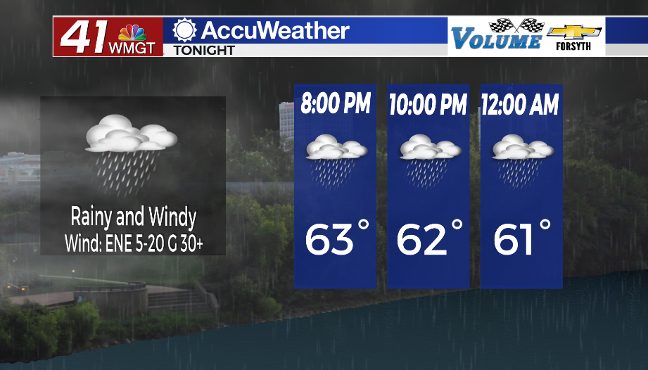
Tonight


Moderate rain and strong winds are expected across Middle Georgia throughout the night. Temperatures will only drop into the upper 50s and lower 60s thanks to the more humid conditions. Sustained winds overnight will range anywhere from 5-20 mph out of the east-northeast, and gusts could push as high as 35. These winds will linger into tomorrow morning along with plenty of rain, so have the raincoats ready to go out the door to begin your Thursday. Anywhere between 1 and 3 inches of rain are possible tonight, and some low lying areas could see flash flooding.
Tomorrow


It will be a wet start to Thursday with light to moderate rain still hanging around from the overnight hours. The good news is that the rain will taper off through the morning hours, leaving some sporadic showers throughout the afternoon and evening. The strong winds from the east-northeast will continue throughout the day, however. Temperatures will peak in the mid to upper 60s in the afternoon. Only the northernmost counties may see any sun at all, and if that happens, it won’t be until late in the day.


Overnight will again be cloudy as a few showers may still persist. Temperatures will only drop into the lower 60s for most of the region as showers remain possible into Friday morning.
Friday and Beyond


Friday will also be overcast with off and on scattered showers likely throughout the day. Temperatures will peak in the upper 60s and lower 70s with ambient winds from the north-northeast at 5-10 mph. Shower activity will wane some in the evening, however they will remain possible until Saturday morning.
The weekend will see more sun with varying temperatures: Saturday will see highs into the upper 70s and lower 80s with winds from the west-southwest at 10-15 mph coming in, gusting upwards of 25 mph. Sunday, however, will see highs in the lower 70s thanks to those winds shifting to the north-northwest during the overnight hours Saturday into Sunday. It will be a below average start next week in regards to temperatures with plenty of sun overhead.

Follow Meteorologist Aaron Lowery on Facebook (Aaron Lowery 41NBC) and Twitter (@ALowWX) for weather updates throughout the day. Also, you can watch his forecasts Monday through Friday on 41NBC News at Daybreak (5-7 a.m.) and 41Today (11 a.m).